Site Layout

Site layout solutions


Site Layout
Trimble RTS573
Versatile enough for light topographic projects and as-built data collection, the RTS573 can handle almost any challenge on the job site.
Learn more

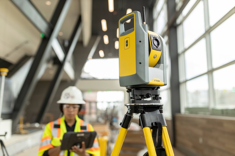
Site Layout
Trimble RTS771
High Precision Positioning for your most demanding projects, this 1" instrument raises the bar in high-accuracy positioning.
Learn more

Site Layout
Trimble RTS773
Incorporates advanced technologies to deliver accurate and reliable layout fast, to ensure that design intent is executed correctly the first time.
Learn more

Site Layout
Trimble RTS873
Improve layout accuracy and speed of DR layout. The RTS873 autofocusing green beam optimizes visibility of placement points at all distances.
Learn more
Our Services
We Support You All the Way
Consulting
We work alongside owners, architects, engineers, and contractors to leverage our deep expertise with the client’s goals and objectives to achieve transformational results.
Learn more
Implementation
Our Professional Services Team and certified BuildingPoint partner network have developed a methodology for success for your complex implementations.
Learn more
Support
We are committed to delivering outstanding Customer Support and Service that complements our offerings of world-class products.
Learn more
The Building Chronicle